Best Running Paths in North York: 11 Trails by Distance (2026)
We mapped every paved valley path, ravine route, and hill-training loop in North York. Each entry below has distance, surface, parking, transit and a Google Maps link — no fluff, no out-of-area filler.
Updated: April 26, 2026 — By North York Guide Team
We ran or walked every path on this list, cross-checked distances against Toronto Parks data and AllTrails, and verified every address against City of Toronto facility records. Last reviewed April 2026.
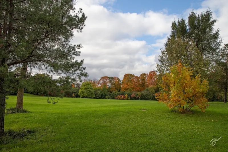
For beginners: Sunnybrook Park (1132 Leslie St) — wide paved 3-5 km loops, no road crossings inside the park.
For long runs: Don Valley spine via Edwards Gardens (755 Lawrence Ave E) — 8-13.5 km of paved valley with optional extensions.
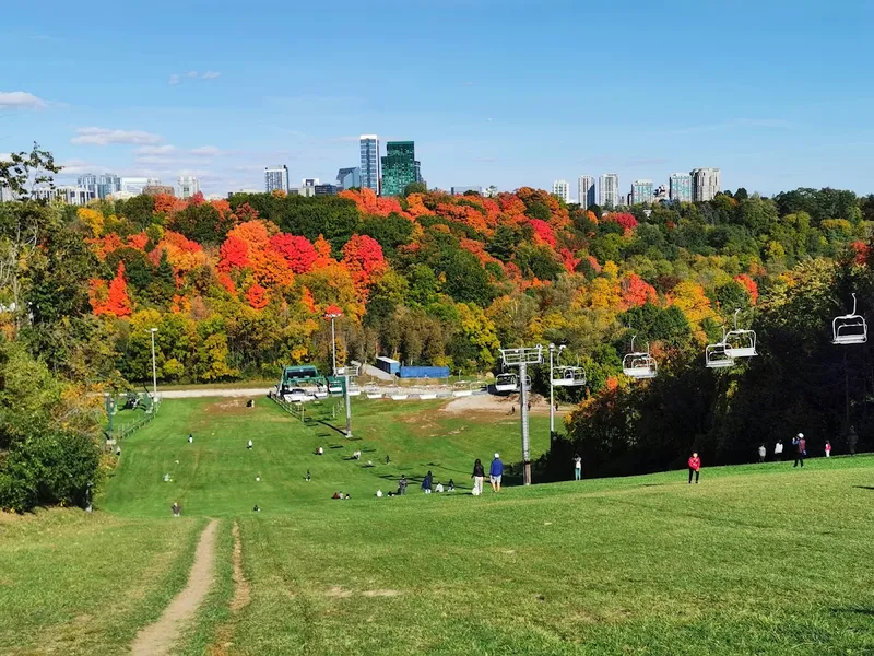
For hills: Earl Bales Park (4169 Bathurst St) — the steep main hill is North York's go-to for repeats.
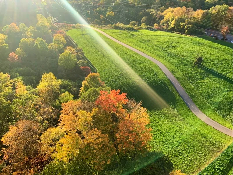
For tempo runs: Finch Hydro Corridor — 15 km of flat paved path under the hydro lines.
How we ranked these
Inside North York — every path either sits within North York's boundaries or has a primary access point inside North York (Yonge corridor through to Eglinton + Steeles).
Verified distance — cross-checked against City of Toronto, AllTrails, and Trailforks data.
Real surface notes — we mark "paved" only for asphalt or concrete; gravel and dirt are called out separately.
Free + free parking — all 11 paths have free entry and free parking nearby (TTC accessible too).
Excludes — race courses, indoor tracks, and routes that require driving outside North York (e.g., Don Mills to Lakeshore is on the hub page, not here).
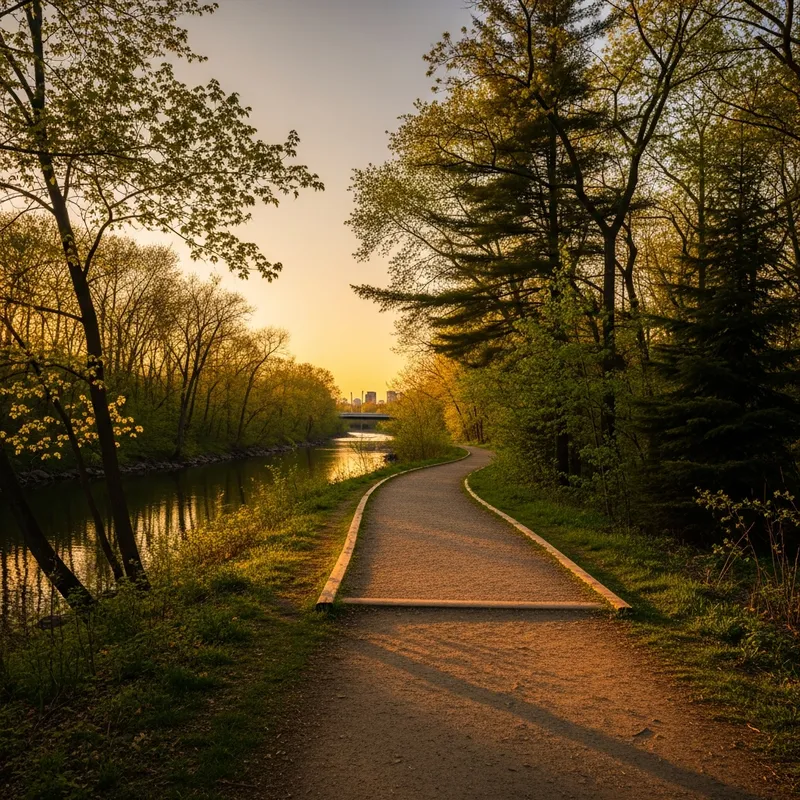
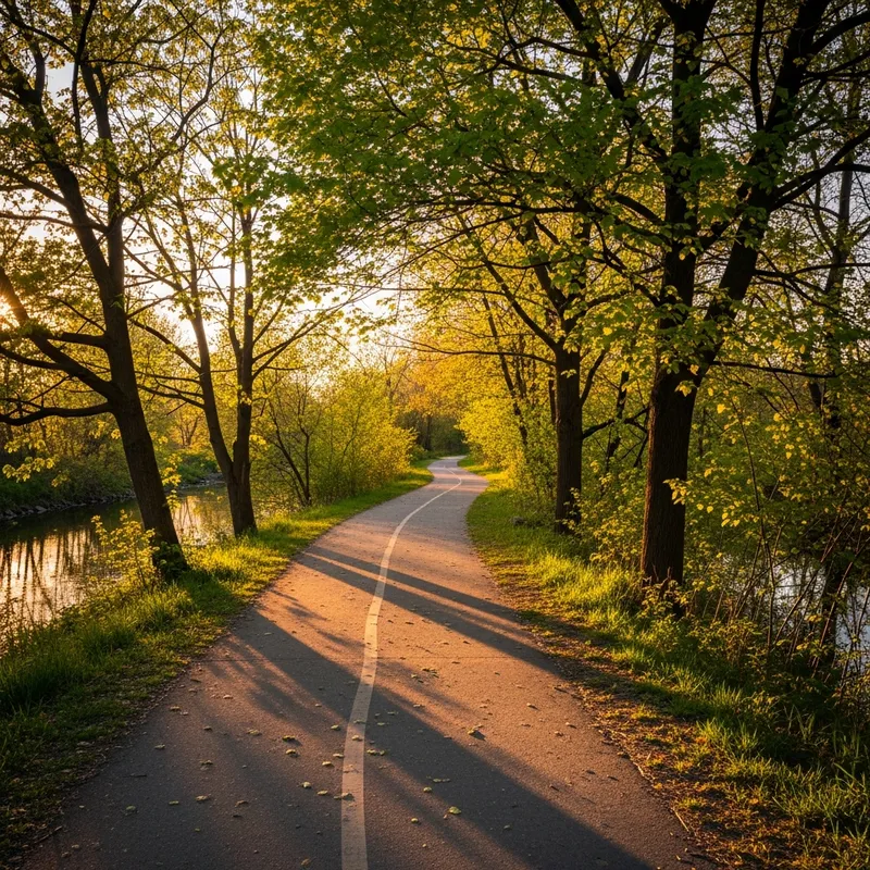
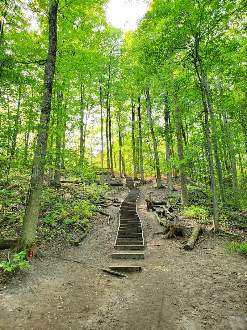
The main paved valley trail through the heart of North York — an asphalt ribbon along the Don River with deep ravine views and minimal street interruption. Surface is smooth asphalt, typically at least 2 metres wide, with wooden bridge crossings. From North York access points you can run anywhere from a 5 km out-and-back to a full 13.5 km push down to the lakeshore.
Access: Edwards Gardens, Sunnybrook Park, E.T. Seton Park, Crothers Woods (Pottery Rd)
Parking: Free at Edwards Gardens, Sunnybrook, E.T. Seton
Transit: Bus 51 (Leslie) to Sunnybrook; Bus 25 (Don Mills) to E.T. Seton
Best season: April–November (icy patches in winter)
Why it's good: The closest thing to a "highway for runners" inside the city. Predominantly flat valley floor with optional steep side trails for hill work.
North York's gold-standard beginner path. Wide, smooth paved paths suitable for strollers, with multiple looping options inside the park boundary so you don't have to cross any roads. Connects directly to the Don Valley spine if you want to extend — making it the single most flexible starting point in the area.
Address: 1132 Leslie St, North York
Parking: Multiple free lots inside the park
Transit: TTC Bus 51 (Leslie) stops at the park entrance
Best season: Year-round (paths are usually plowed)
Why it's good: No road crossings, flat, well-lit at dusk in summer, and a built-in coffee stop at the equestrian centre concession.
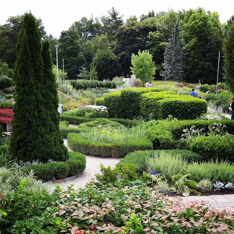
The most scenic place to start a run in North York. Manicured botanical gardens give way to wooden bridges over Wilket Creek, then a wooded valley trail that links into Sunnybrook and Serena Gundy Park. Over 20 km of connected trails total — pick your distance and turn around.
Address: 755 Lawrence Ave E, North York
Parking: Free lot off Lawrence Ave E (busy weekends)
Transit: Bus 54 (Lawrence East) to Lawrence & Leslie
Best season: Spring (tulips), fall (foliage); avoid weekends 11am–3pm in summer for crowds
Why it's good: The combination of formal-garden start and wild-ravine middle gives you the most visual variety per kilometre in the city.
A long, mostly-flat paved valley path along the West Don River, popular with cyclists and runners alike. The Don Trail and Beaver Flats segment is roughly 4.2 km with mild rolling sections and a gentle elevation gain. Connects north into Edwards Gardens and south into the Lower Don system.
Access: Off Don Mills Rd south of Eglinton; entrance near Thorncliffe Park Dr
Parking: Free lot inside the park
Transit: Bus 25 (Don Mills) or 100 (Flemingdon Park)
Best season: Year-round (paved sections cleared in winter)
Why it's good: Quieter than Sunnybrook on weekends, and the riverside flow gives you a continuous sense of progress without lots of switchbacks.
The longest paved path crossing North York — about 15 km running east-west under the hydro towers between roughly Bayview and Jane. Flat, fully paved, and largely traffic-free. There are a handful of arterial road crossings (Bathurst, Yonge, Bayview), and the trail does break briefly just west of Yonge before picking back up at Willowdale.
Access: G. Ross Lord Park, Hendon Park (Yonge), Earl Bales Park
Parking: Free at G. Ross Lord and Earl Bales
Transit: TTC Finch Station (Line 1) is the most central access point
Best season: April–November (exposed; hot in summer, windy in winter)
Why it's good: Flat, fast, no decisions to make. The single best path in the city for steady-state tempo runs.
~5 km loopPaved + NaturalEasy–ModerateWinter-Friendly
6. G. Ross Lord Park Loop
The closest thing to a "round number" 5K loop in central North York — the perimeter trail circles a flood-control reservoir with a network of about 4 km of secondary paths branching off. Mix of paved multi-use path and natural single-track. AllTrails clocks the popular loop at roughly 3.2 miles (5.1 km) with about 60 m of elevation gain.
Address: 4801 Dufferin St, North York
Parking: Free lot off Dufferin Street
Transit: Bus 105 (Dufferin) or 60 (Steeles West)
Best season: Year-round — this is one of the few North York paths that consistently gets cleared in winter
Why it's good: Locally beloved as a "winter run" because the perimeter trail tends to be plowed and the reservoir blocks wind.
The hill-training spot for North York runners. 127 acres along the West Don River with a steep main hill (the same one used as a winter ski slope) plus rolling natural trails through the valley. Paved access roads make it easy to repeat sets without worrying about footing.
Address: 4169 Bathurst St, North York (M3H 3P7)
Parking: Multiple free lots inside the park
Transit: Bus 7 (Bathurst) to Bathurst & Sheppard, then a short walk south
Best season: April–November for hill repeats; mid-winter the hill becomes a ski/tube run
Why it's good: One sustained climb long enough to do real interval work, and the surrounding paved network gives you 30–90 second active recovery between reps.
A short paved East Don River trail that runs from Sheppard Ave to Duncan Mill Rd, crossing under Highway 401. Just 1.85 km one way (so 3.7 km round trip), but reliable, family-friendly, and wheelchair-accessible the whole way. A favourite for stroller jogs and post-work shakeouts.
Access: Trail entrance at Leslie St & Sheppard Ave (north end) or Don Mills Rd & Duncan Mill Rd (south end)
Parking: Street parking around Henry Farm; small lot at Duncan Mill end
Transit: Leslie subway station (Line 4) is a 10 min walk to the north entrance
Best season: Year-round (paved, partially sheltered under 401)
Why it's good: Combine two return trips (3.7 km × 2 = 7.4 km) for a clean tempo loop with minimal road exposure.
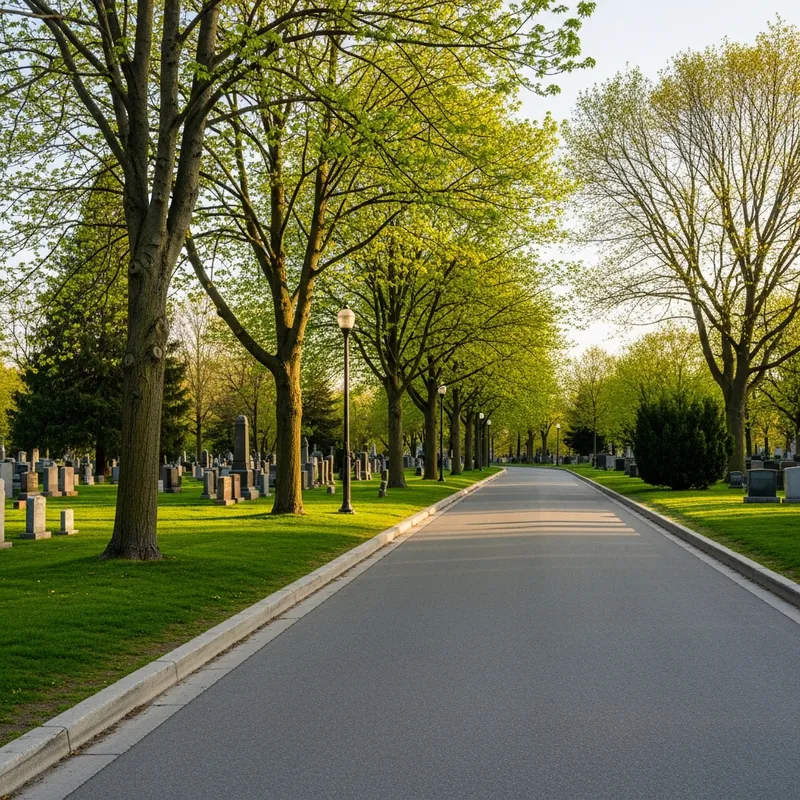
A "hidden gem" run option just west of Yonge & Sheppard. Quiet paved cemetery roads, virtually no traffic, and a network of internal loops adding up to 3–5 km depending on how many you string together. Senlac Road runs south through the middle of the cemetery and the back ravine connects out. Be respectful: keep the volume down, no music on speakers, and yield to mourners.
Address: 160 Beecroft Rd, North York (main entrance)
Parking: Free at Sheppard Ave entrance and along Senlac
Transit: TTC Sheppard-Yonge subway station, then a 5 min walk west
Best season: Year-round — cemetery roads are kept clear in winter
Why it's good: When sidewalks are icy and the ravines are unusable, this is the most reliable winter loop near the Yonge corridor.
A flat, wide, paved former-rail corridor running east-west through midtown Toronto. Accessible from the south edge of North York at Allen Rd / Eglinton (near Yorkdale and Lawrence West stations), it links into Mount Pleasant Cemetery and the Don Valley system on the east end. About 9 km end-to-end; do it as an out-and-back from the North York side or one-way with a TTC return.
Access: Allen Rd / Eglinton (west end) or Mount Pleasant / Davisville (east end)
Parking: Limited; TTC is recommended
Transit: Eglinton West Station (Line 1) for the west end
Best season: Year-round (paved; partial tree cover for shade)
Why it's good: The flattest, widest, most uninterrupted paved run available from the south edge of North York.
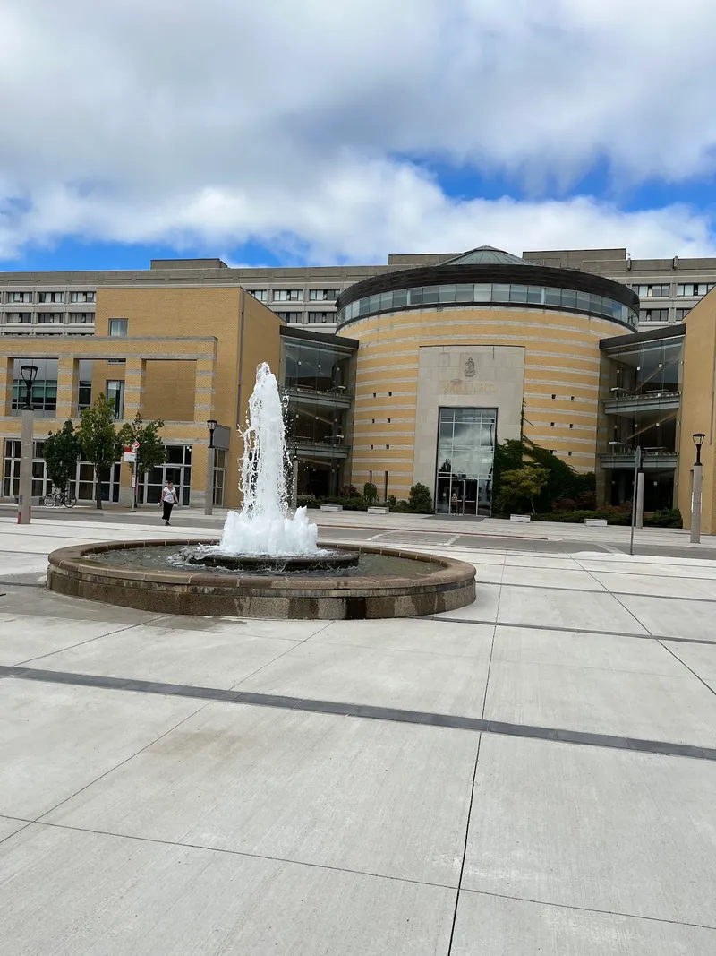
The Keele campus has wide paved pedestrian paths between Keele St and Highway 400 (east-west) and from Steeles Ave south to Finch (north-south). At the north end off Steeles, there's an outdoor 400m running track typically open to the public outside university athletics hours. Best in the early morning or evening when the campus is quiet.
Address: 4700 Keele St, North York (campus map)
Parking: Paid lots on campus; free street parking on side streets
Transit: TTC Pioneer Village Station (Line 1) drops you on campus
Best season: Year-round; track availability varies during athletics season
Why it's good: The only outdoor public track conveniently accessible from the north end of North York. Confirm track access at the front desk of Tait McKenzie Centre before showing up.
If you want races, group runs, or beginner-friendly programs, the main hub has the full picture. For nature-first walking and seasonal trails, see our nature guides. Mother's Day weekend ahead? Pair a run on one of these paths with our Mother's Day in North York guide for brunch reservations and gift ideas.
What is the best running path in North York for beginners?
Sunnybrook Park (1132 Leslie St) is the best beginner path in North York. The paved paths are wide, smooth, stroller-friendly, and offer 3–5 km loops with no street crossings inside the park. The Finch Hydro Corridor (15 km, fully paved, very few intersections) is the best option if you want a flat, no-decisions tempo run.
Where can I run a 5K loop in North York without crossing roads?
G. Ross Lord Park (4801 Dufferin St) has a roughly 5 km perimeter loop around the reservoir with no road crossings. Sunnybrook Park (1132 Leslie St) offers a similar 3–5 km loop on paved paths inside the park boundary. Both are free and open year-round.
What's the longest paved running path in North York?
The Finch Hydro Corridor Recreational Trail is the longest paved path through North York at approximately 15 km, running east-west under the hydro lines. It's flat, fully paved, and ideal for tempo runs. Note that it does have a few road crossings at major arteries (Bathurst, Yonge, Bayview).
Where can I do hill training in North York?
Earl Bales Park (4169 Bathurst St) is the go-to spot for hill repeats in North York. The park's 127 acres include a steep main hill with paved access, plus rolling natural trails through the West Don River valley. The side trails off the Don Valley spine (Crothers Woods, Riverdale) are the other serious option for hill work.
Are North York running trails open in winter?
Most paved trails are open year-round but not always plowed. Reliably-cleared winter options are: Earl Bales Park (paved paths get cleared), G. Ross Lord Park perimeter (popular with locals in winter for its plowed paths), and York Cemetery (clear, traffic-free roads). Avoid the natural ravine trails after snow — they're slick and unmaintained.
How do I access the Don Valley trails from North York?
The easiest North York access points to the Don Valley / Lower Don Trail system are: Edwards Gardens (755 Lawrence Ave E), Sunnybrook Park (1132 Leslie St), E.T. Seton Park (Thorncliffe Park Dr), and Serena Gundy Park (off Don Mills Rd south of Eglinton). All have free parking and connect to the Wilket Creek and Don Valley spine, giving you 5–25+ km options.
Where is the best running path with scenery in North York?
Edwards Gardens (755 Lawrence Ave E) is the most scenic starting point — manicured gardens, wooden bridges over Wilket Creek, then natural valley trail down through Wilket Creek Park toward Sunnybrook. The Lower Don Trail down through Crothers Woods is the runner-up: deep ravine, river crossings, and minimal urban interruption.